| Waypoint |
Leg Description |
| Taylor Ranch Library |
Ride south on Unser to Central Ave. |
| Central Ave |
Turn right (west) on Central; up 9-mile hill to Paseo del Volcan - Re-group at the gas station |
| Paseo del Volcan |
Turn left (south) on Paseo del Volcan to the intersection with Dennis Chavez Blvd. |
| Dennis Chavez Blvd |
Curve left (east) (down the hill) on Dennis Chavez to
Coors; road turns into Rio Bravo Blvd. |
| Rio Bravo Blvd. |
Continue straight (east) on Rio Bravo; after crossing the Rio Grande, turn right onto the frontage
road at the first opportunity and loop back west to the Riverside Trail |
| Riverside Trail |
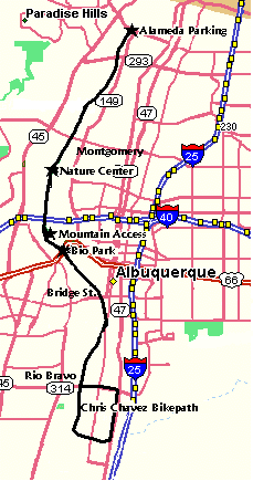
Turn left (south) on the Riverside Trail which curves left (east), then east then north on the Chris Chavez Loop to the Chris Chavez Memorial; hop the guardrail at this point to return to Rio Bravo. |
| Rio Bravo Blvd. |
Turn right (east) on Rio Bravo, which turns left (north) after passing under I-25 and becomes University
Blvd. |
| University Blvd. |
Ride north on University; at the point where the road begins to turn right (east) and becomes Randolph
Ave, hop the curb on the west side and walk your bike about 20 feet to the get on University again. |
| |
Continue north on University to César Chavez Blvd; Re-group at this point. |
| César Chavez Ave. |
Turn left (west) on César Chavez; after passing under I-25, take the first turn to the south
- High Street. |
| High St. |
Turn left (south) on High Street 2 blocks, which T's into Dennis Chavez
Park. |
| Kathryn |
Turn right (west) on Kathryn to Edith Blvd. |
| Edith Blvd |
Turn right (north) on Edith 4 blocks to reach César Chavez again. |
| César Chavez |
Turn left (west) on César Chavez, which turns into Bridge Blvd at 2nd Street. |
| Bridge Blvd. |
Turn right (north) at 8th Street; after 4 blocks, |
| Marquez |
Turn left (west) on Marquez to reach Tingley Drive and the Riverside Trail again. |
| Riverside Trail |
Turn right (north) on the Riverside Trail to the Mountain Road exit. |
| Mountain Rd. |
Turn right (east) on Mountain Road, passing by Reginald Chavez Elementary
School. Continue east on Mountain through Rio Grande Blvd. to Romero St. |
| Romero St. |
Turn right (south) on Romero Street at Old Town, just east of Rio Grande Blvd., about .15 of a mile
to the Old town Plaza, for a re-group and food stop at Rolling in Dough Cafe which is west of the plaza past the
public restrooms. |
| For those interested in a shorter ride, the Old Town stop is the departure point. This group would
return via Mountain Road to the Bosque Trail; north on the Bosque Trail to Montaño; west on Montaño
to Unser and the Taylor Ranch Library. This route takes you by Mayor Martin Chavez' home, which is visible from
the Riverside Trail just south of the bridge crossing the canal. Total distance for this shorter ride is about
40 miles. |
| Rolling in Dough (Old Town) |
From Rolling in Dough, ride south on Romero, then ride counter-clockwise around Old Town Plaza,
ride north on San Felipe to Mountain Rd., turn right (east) on Mountain at the traffic light. |
| 7th St. |
Turn south at 7th Street, to Tijeras Ave.
At Tijeras, stay on the bike route by jogging west to the continuation of 7th Street.
Ride south on 7th Street to Gold Ave. |
| Gold Ave. |
Turn left (east) on Gold, past the Dennis Chavez Federal Building, to 5th Street. |
| 5th St. |
Turn left (north) on 5th Street, to Tijeras Ave. |
| Tijeras Ave. |
Turn right (east) on Tijeras, pass the City Hall and Mayor Martin Chavez'
office and then past the statue of Sen. Dennis Chavez at the SE corner of Civic Plaza,
Continue east as the street becomes Martin Luther King Jr. Blvd, to Edith Blvd. |
| Edit Ave. |
Turn right (south) on Edith back to César Chavez Blvd. |
| César Chavez Blvd |
Turn left (east) on César Chavez, which
turns into Santa Clara Ave at Yale Blvd. |
| Santa Clara Ave |
Continue east on the bike route on Santa Clara to Carlisle Blvd. |
| Carlisle Blvd. |
Turn right (south) on Carlisle to Gibson Blvd. |
| Gibson Blvd. |
Cross Gibson and turn left (east) on the bike trail on the south side of Gibson. |
| San Mateo Blvd. |
At the intersection with San Mateo, turn right (south) into the Veterans' Hospital entrance veer
left (east) and ride around the north side of the hospital through the hospital parking lots.. |
| San Pedro |
Jog left (north) on San Pedro for a short distance to Ridgecrest. |
| Ridgecrest |
Turn right (east) on Ridgecrest to Louisiana |
| Louisiana |
Turn left (north) on Louisiana; shortly after crossing Gibson, turn right (east) into the Veterans'
Memorial parking lot. |
| Veterans' Memorial parking lot |
Ride through the parking lot to connect on the north side with the path leading to the César Chavez Community Center and Phil Chacon Park. |
| Cesar Chavez Community Center |
Re-group at Cesar Chavez Community Center.
Exit Phil Chacon Park on the north side. on Southern Ave. |
| Southern Ave. |
Turn right (east) onto Southern Ave. to Utah Ave. |
| Utah Ave. |
Turn left (north) on Utah; after crossing Lomas Blvd, follow the bike route west and north on Marble/Texas/Mountain
to reach Pennsylvania Ave. |
| Pennsylvania Ave. |
Turn left (north) on Pennsylvania to Osuna Rd. |
| Osuna Rd. |
Turn right (east) on Osuna to Wyoming Blvd. |
| Wyoming Blvd. |
Turn North on Wyoming; get on the bike trail after passing Academy. |
| Harper Road |
At the intersection of Wyoming and Harper Road, stay on the bike trail and head east along Harper
for a short distance.
Cross Harper to head north on Barstow Street. |
| Barstow Street |
Re-group at Dennis Chavez Elementary School on
Barstow.
Continue north a short distance to the S. Domingo Baca Arroyo bike trail |
| S. Domingo Baca Arroyo bike trail |
Turn left (west) on the bike trail to San Pedro |
| San Pedro |
Turn right (north) on San Pedro to Alameda Blvd. |
| Alameda Blvd. |
Turn left (west) on Alameda to Jefferson Blvd. |
| Jefferson Blvd. |
Turn left (south) on Jefferson; cross Paseo Del Norte and take the next turn west onto El Pueblo
Road |
| El Pueblo Road |
Turn right (west) on El Pueblo Road to the North Diversion Channel bike trail |
| N Diversion Channel bike trail |
Turn right (south) on the bike trail to Osuna Road. |
| Osuna Road |
Turn right (west) on Osuna Road; at the 4th Street intersection, cross 4th Street and enter the
shopping center parking lot. Ride through the parking lot to the south side, to come out onto Chavez
Avenue. |
| Chavez Avenue |
Turn west on Chavez Avenue to Rio Grande Blvd; notice that this street turns into Chavez Road. |
| Chavez Road |
Turn left (south) on Rio Grande to Montaño Road. |
| Montaño Road |
Turn right (west) on Montaño to Unser Blvd and the Taylor Ranch Library. |
| Taylor Ranch Library |
Finis -- total distance estimated at 67 miles and a total of 13 Chavez-named places. |