La Madera Climb
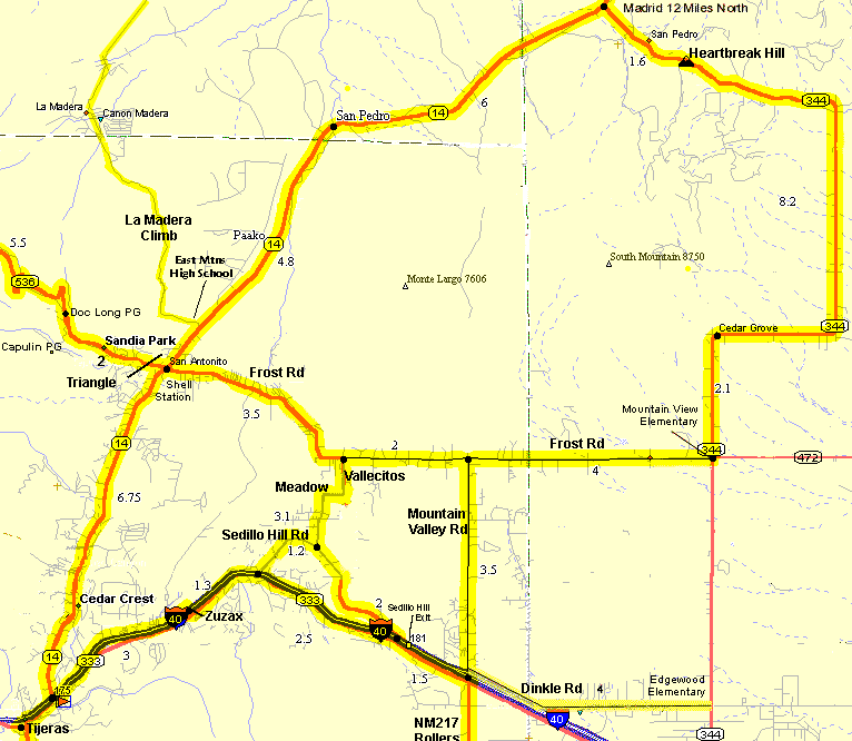
The La Madera Climb is a short but challenging climb that can be added as an option to rides on north NM14, 1.5 miles north of the "Triangle". The La Madera Climb has sweeping views of the Sandia Mountains, the Sangre de Cristo Mountains at Santa Fe, South and the Ortiz Mountains. There are a couple of steep climbs and tight turns on the descents but it is fun. The route passes the East Mountains High School and the community center near the intersection with NM14. Once past the school you ride into Ponderosa forest and start climbing. There are a couple of steep short climbs and then the pavement ends at the fire station . Don't despair, just when you climb the worst section it levels off. If you have the time and energy it is a pleasant diversion off north-14.
Getting There: The intersection is 1.5 miles north of the "Triangle" at NM14 & Frost Road & the Sandia Crest Road. Turn west at the intersection. The Vista Grande community center and a number of athletic fields are at the intersection.Distance: 7 miles each way, total 650' elevation gain (575' in). The pavement ends at the fire station.
Options: There are many options in the East Mountains, including adding Heartbreak Hill, the S-14 Rollers (NM217), Madrid Gold Rush, La Madera, and more.
The dirt La Madera Rd. meanders north for a total of 11 miles to the dirt Puercocito Rd which continues east 6 miles back to NM14 at about milepost 15, near the NM344 turnoff at Heartbreak Hill. It goes through an interesting canyon on Puercocito Rd. You need a moutain bike although it is a maintained dirt road.
Roadway: Paved, 2-lanes, through forested hills. The pavement from NM14 to La Madera is nice new pavement (2006) but past the village the pavement narrows for another 3 miles and often has lots of sand and gravel on it.
Area Map
La Madera Elevation Profile
Don't get scared, note that the elevation range is only about 300 feet. There is a couple of short steep climbs.
