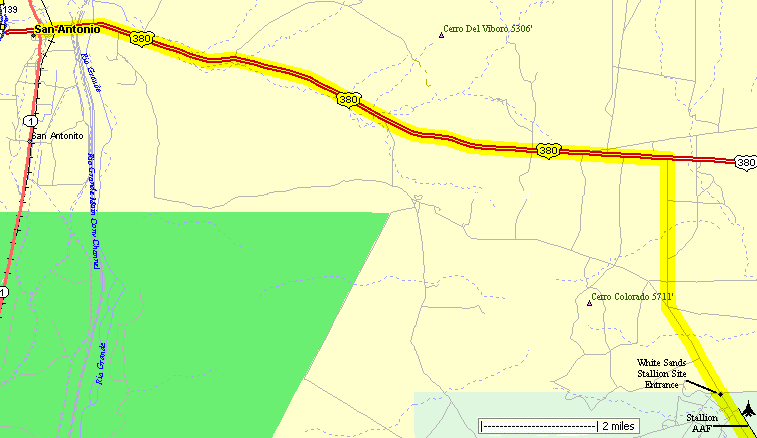
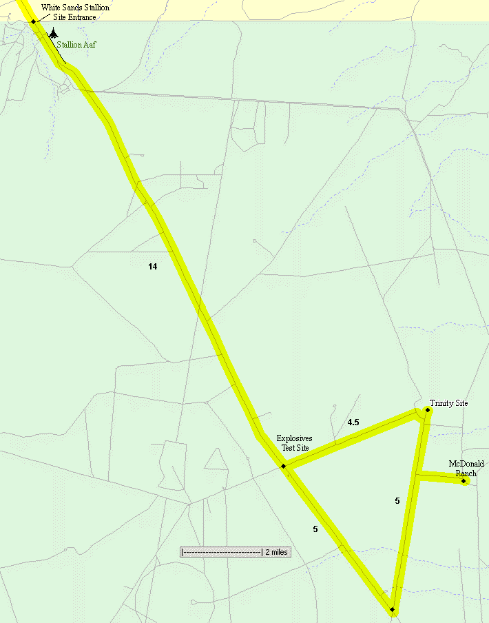
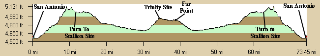
There is no public vehicular traffic after entering the Stallion gate which is a real treat. Since we ride on the weekend there is very little worker vehicle traffic. Spring or fall is the best time for this ride since it is very hot in the summer. From San Antonio ride east about 12 miles on US380 to the Stallion Range turnoff. Then ride south about 5 miles to the Stallion Range entrance. At the entrance you can pickup pamphlets if you don't have one. Then ride south about 13 miles south. Turn left (east) at the Permanent High Explosive Testing Site (there are signs) and ride the final 4 miles. Soon after the turn the circular Trinity Site area can be seen in the distance. A side trip to the McDonald ranch, where the first bomb was assembled, is sometimes allowed on the way south. This is about a mile off the pavement on a packed gravel road rideable by road bikes and tandems. There is no food or water or other services along the route, so come prepared. The range is normally closed so this ride must be arranged with the White Sands Missile Range personnel. You must carry picture id on you while on the range. Port-a-johns are available a the gate and at the Trinity site. Riders must not leave the road due to the presence of unexploded ordnance. Photographs may be taken at the Trinity Site but not anywhere else along the route. Have a green-chili cheeseburger at the original Owl Cafe in San Antonio after the ride. |
||
| The WSMR is normally closed to the public. The NMTS is sometimes able to offer this tour once a year with the cooperation of the White Sands Missile Range. Watch the bulletin for a fall / winter ride. Don't ride out there on your own expecting to get in - you won't. | ||
Getting There: This description starts and ends in San Antonio. Take I-25 south from Socorro 10 miles to US380, exit 139 and turn east, driving less than a mile to San Antonio. A 34 mile / 800' option is possible by parking outside the Stallion Range entrance, east of San Antonio.
Roadway: The roads to the Trinity Site in the missile range are paved, two lanes with almost no traffic since it not open to public vehicular traffic during bike rides. US380 is pretty flat, 2-lanes, with light traffic. The side trip to the McDonald ranch, if allowed, is about 1 mile of packed gravel road each way that is easily rideable by road bikes or tandems.
Options:
- A 34 mile / 800' option is possible by parking outside the Stallion Range entrance, east of San Antonio.
- An approximately 1-mile side trip on a packed gravel road to the historic McDonald Ranch south of the Trinity Site is sometimes allowed by the WSMR staff.
- The Bosque del Apache Wildlife Refuge is about 8 miles south of San Antonio which has packed dirt roads that are a nice afternoon ride to view the birds.
Notes:
- The area is normally closed so this ride must be arranged with the White Sands Missile Range by the club, not individuals.
- For more information contact the missile range Public Affairs Office at (505) 678-1134/1700.
- Rider requirements by WSMR:
- You must carry a picture id on you while on the range.
- Riders must not leave the road due to the presence of unexploded ordnance.
- Cameras are allowed at Trinity Site but their use is strictly prohibited anywhere else on White Sands Missile Range.
- Port-a-johns are available outside the Stallion gate and at the Trinity Site.
- The Trinity Site is usually open to public vehicular traffic only once in April and October, check with the White Sands Missile Range for other rides.
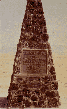
- Trinity Site Website