 |
|
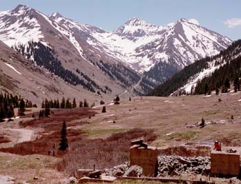
Animas Forks |
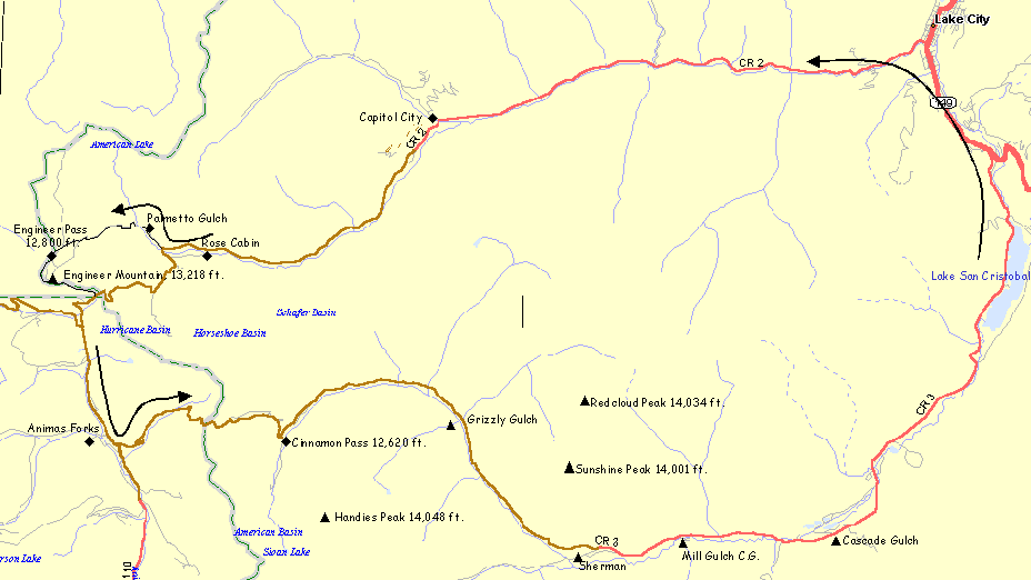
The route is mainly on well maintained 4WD roads that are well signed. There are even several bathrooms placed along the way. Take plenty of water, food and rain gear since it's very exposed on top. The Alpine Loop was one of BLM's first Scenic Byways. Outside magazine listed the Alpine Loop as one of the 10 best rides in the country.
Getting There: The starting location is typically in Lake City, Colorado. There are a number of motels and RV camprounds in Lake City.
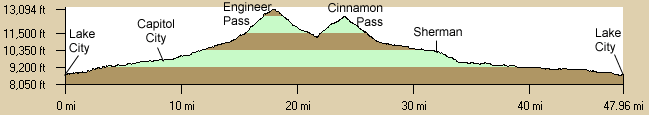
Distance: 52 Miles, 5,630 ft. Elevation Gain, Mostly on 4WD roads at high elevations (>12,000 ft.), some steep climbs.
Notes:
- Backroads of the San Juan Mountains, Alpine Loop Scenic Backcountry Byway Map, Backcountry Travelers Inc., 340 Lakewood Drive, Durango, CO 81301, 303-259-4616, 1994, ISBN: 1928759009 - A very detailed 4WD strip map of the route sometimes available in Lake City and available from Amazon.com.
- Durango, Silverton, Telluride, Pagosa Springs, and Cortez Bike Map, Trails Illustrated #504, also available from Amazon or Trails Illustrated.
- Bicycle On Public Lands of Southwest Colorado, Third Edition. - See Ride #39 - Lake City Overnight.
- BLM Gunnison Office - The Alpine Explorer, a 20-page guide to the area is available from the BLM and the Western Colorado Interpretive Association for $2.50 (make checks payable to WCIA). They have lots of other publications available.
- GORP Alpine Loop - Generic writeup.
- The Mill Creek (BLM) and Williams Creek Campgrounds are upstream (west) of San Cristobal Lake and have first-come access. If you're coming downhill you can load up with water at Mill Creek for the rest of the downhill ride.
- There are several grocery stores, gas stations, and motels in Lake City.
Options:
- There are additional side trips if you haven't had enough. At the turn to Engineer Pass you will see the old mining town of Animas Forks several hundred feet of elevation below. This is an interesting side trip but you have a lot of climbing to get Sback to the junction.
- You could also start in Silverton or Ouray.
- There are also rides out of Silverton.
- Bag a couple of 14'ers.
- Cottonwood Creek Trail (BLM)
- Wager Gulch Trail (BLM).
- Rio Grande National Forest.
- Rio Grande National Forest trails east of Lake City towards Slumgullion Pass.
|
||||||||||||||